|
||
|
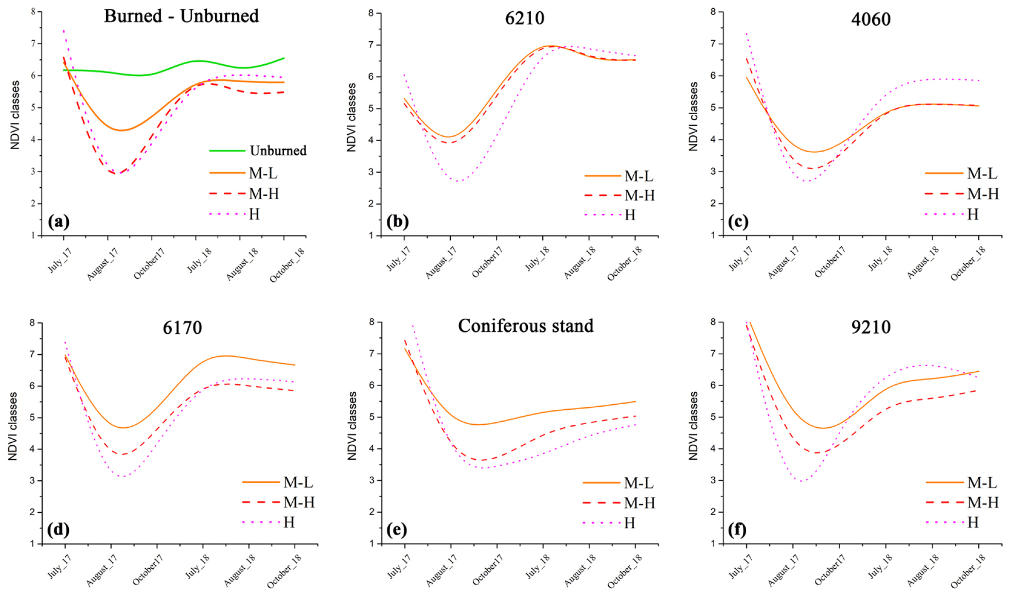
NDVI trends of the total burned and unburned area, and within ‘burn severity’ classes, in the threatened habitats. ‘Burn severity’ classes: M-L = Moderate-Low Severity (orange solid line); M-H = Moderate-High Severity (red dash line); H = High Severity (violet dotted line). (a) NDVI average trends of unburned areas in a 500 meters buffer around the burned scar (green solid line), and ‘burn severity’ classes (M-L, M-H, H) for the total threatened area. The other graphs represent the NDVI average trends within the ‘burn severity’ classes for different Annex I habitats plus coniferous stands: (b) 6210* (Semi-natural dry grasslands and scrubland facies on calcareous substrates), (c) 4060 (Alpine and boreal heaths), (d) 6170 (Alpine and subalpine calcareous grasslands), (e) coniferous stands, (f) 9210* (Apennine beech forests with Taxus and Ilex). The habitats 6230* [Species-rich Nardus grasslands, on siliceous substrates in mountain areas (and sub-mountain areas, in Continental Europe)], 6430 (Hydrophilous tall herb fringe communities of plains and of the montane to alpine levels) and 8210 (Calcareous rocky slopes with chasmophytic vegetation) are not included because of the limited extent of their patches. |